Tourism in Afghanistan
.jpg)
.jpg)
.jpg)
.jpg)
.jpg)

Tourism Industry
What is tourism? Tourism is defined and understood as the activity of travelling and touring. It is basically a set of inter-connected activities of tourists while travelling to a place. And, so tourism as an industry means and covers the same things but from an economic and monetary point of view. Tourism industry is and comprises of all the companies which provide the products and services that are meant and used by tourists at different stages of travel and tourism. Tourism is a very vast, vibrant, dynamic and growth oriented industry. Tourism as an industry is the set of all business activities which serves the needs tourists while they visit different places by way of tourism, touring or travelling. Tourism is in fact a very broad industry comprises of different sectors or sub industries which produce and offer various similar and different products and services which create the demand for tourism and actually make the act of touring and travelling for tourism possible.
Tourism in Afghanistan
Tourism in Afghanistan was at its glorious best in the 1970s. Over 90,000 tourists visited Afghanistan from all over the world to see the unique beauty of the country and experience the treat of one of the most hospitable people. A valid passport with visa is required for entrance into Afghanistan. In 1999, the United Nations estimated the daily cost of staying in Kabul at $70 USD. Many tourists from around the world came to visit Afghanistan, including from as far away as Europe and North America. All of that ended with the start of the April 1978 Saur Revolution. However, it is again gradually increasing despite the insecurity. Each year about 20,000 foreign tourists visit Afghanistan. Tourists should avoid areas where armed criminals operate in the name of Taliban. As a policy, the Taliban are known not to harm tourists. Distinguishing the two groups is very difficult.Afghanistan has four international airports, including the Hamid Karzai International Airport, Mzaar-e Sharif International Airport, Kandahar International Airport and Herat International Airport. It also has several smaller airports throughout the country. Guest houses and hotels are found in every major Afghan city. Some of the major hotels in Kabul are the Serena Hotel, the Hotel Inter-Continental Kabul, and the Safi Landmark Hotel.
Table of Contents
1. Kabul Province2. Bala Hissar
3. Darul Aman Palace
4.Gardens of Babur
5.National Museum of Afghanistan
6. Paghman
7. Qargha
8. Balkh Province
9. Ai- Khanoum
10. Cheshmeh-ye Shefa
11. Bamiyan Province
12. Amir Dam
13. Boddhas of Bamiyan
14. Shahr-e Zuhak
15. Mazzar-e Sharif
16. Kabul Province
17. Kandahar Province
18. Cloak
19. Ghazni Province
20. Ghazni Minerats
21. Ghor Province
22. Minerat of Jam
23. Badakhshan Province
24. Shiva Lake
25. Herat Citadel
27. Panjshir Province
28. Panjshir Valley
29. Samangan Province
30. Takht-e Rustam
Kabul
Kabul, capital of Afghanistan since 1776, is a fast growing city where tall modern buildings nuzzle against bustling bazaars, wide avenues are field with colorful flowing turbans, gaily striped chapans and a multitude of handsome faces. Kabul has a couple of places for tourists and it could be one of the tourism centers around the world. Because of the historical places and the gardens it has. Moreover, the facilities which Kabul and the people of Kabul prepared for tourists, like: Hotels, Guest houses and the international airport which is located in Kabul.
1. Bala Hissar
Bala Hissar ("High Fort") is an ancient fortress located in the south of the old city of Kabul, Afghanistan. The estimated date of construction is around the 5th century AD. Bala Hissar sits to the south of the modern city centre at the tail end of the Kuh-e-Sherdarwaza Mountain. The Walls of Kabul, which are 20 feet (6.1 m) high and 12 feet (3.7 m) thick, start at the fortress and follow the mountain ridge in a sweeping curve down to the river. It sports a set of gates for access to the fortress. The Kōh-e Shēr Darwāzah (lion door) mountain is behind the fort. Bala Hissar was originally divided into two parts: The lower fortress, containing the stables, barracks and three royal palaces, and the upper fortress (the actual fort with the name Bala Hissar) housing the armory and the dungeon of Kabul, known as the "Black Pit" (the Siyah Chal). When looking at the outer wall of the main fortress, it is possible to see layers of building materials from years of destruction and re-fortification. The tanks and other war wreckage from the last 30 years are strewn about the top of the hillside.
.jpg)
2. Darul Aman Palace
Darul Aman Palace means "abode of peace" is a palace located about 16 kilometers (9.9 mi) south-west outside of the center of Kabul, Afghanistan. It sits directly across from the Afghan Parliament, and is close to the National Museum of Afghanistan and the American University of Afghanistan. In 2019, the palace was fully renovated for the 100th year of Afghan Independence, which was on the 19th of August, 2019. Construction of the Darul Aman Palace began in the early 1920s as a part of the endeavors of King Amanullah Khan to modernize Afghanistan. It was to be part of the new capital city called Darulaman, connected to Kabul by a narrow gauge railway. Amanullah Khan invited 22 architects from Germany and France to build the palace. The palace is considered to be a testimony of the Afghan-German ties, as it was designed by German engineer Walter Harten and his team of engineers. The palace is an imposing neoclassical building on a hilltop overlooking a flat, dusty valley in the western part of the Afghan capital. Designed by French architects A. Godard and M. Gordad, as well as German architects, it was one of the first buildings in the country to get central heating and running water. The palace is a U-shaped brick building, built in a European neoclassical style. It has 3 floors with 150 rooms, including a semi-circular main hall. Its highest point is around 33 m (108 ft) above ground level. There are four domed towers on the roof. The galleries on the third floor of the southern facade are decorated with a number of Corinthian columns. Each floor is connected by marble spiral staircases.
.jpg)
3. Gardens of Babur
The Garden of Babur locally called Bagh-e Babur is a historic park in Kabul, Afghanistan, and also the final resting-place of the first Mughal emperor Babur . The garden is thought to have been developed around 1528 AD (935 AH) when Babur gave orders for the construction of an "avenue garden" in Kabul, described in some detail in his memoirs, the Baburnama. It was the tradition of Mughal princes to develop sites for recreation and pleasure during their lifetime, and choose one of these as a last resting-place. The site continued to be of significance to Babur's successors, Jahangir and his step-mother, Empress Ruqaiya Sultan Begum (Babur's granddaughter) made a pilgrimage to the site in 1607 AD (1016 AH) when he ordered that all gardens in Kabul be surrounded by walls, that a prayer platform be laid in front of Babur's grave, and an inscribed headstone placed at its head. During the visit of the Mughal Emperor Shah Jahan in 1638 (1047 AH) a marble screen was erected around tomb of his foster-mother, Ruqaiya Sultan Begum, and a mosque built on the terrace below. There are accounts from the time of the visit to the site of Shah Jahan in 1638 (1047AH) of a stone water-channel that ran between an avenue of trees from the terrace below the mosque, with pools at certain intervals. The garden is surrounded by high walls, rebuilt by the local community. Visitors are greeted by a large traditional caravanserai which is planned to open as a visitors’ center, showing many of the finds excavated in the archaeological dig that preceded the restoration. Although modern, it stands on the footprint of an older building of the same plan built as a refuge for the poor in the 1640s. The garden is 11.5 c. large and arranged in 15 terraces along a central axis in an east-west direction. From the top terrace, the visitor has a magnificent vista over the garden and its perimeter wall, across the Kabul River towards the snow-covered mountains. The present garden extends over fifteen orchard terraces that descend westward towards the Kabul River. The overall layout is rectangular in plan, with an extension containing a caravanserai and another containing the burial terraces at the foot and head of the central axis.
.jpg)
4. National Museum of Afghanistan
The National Museum of Afghanistan in Persian; Mūzīyam-e mellī-ye Afghanistan also known as the Kabul Museum, is a two-story building located 9 km southwest of the center of Kabul in Afghanistan. As of 2014, the museum is under major expansion according to international standards, with a larger size adjoining garden for visitors to relax and walk around. The museum. was once considered to be one of the world's finest. The museum's collection had earlier been one of the most important in Central Asia, with over 100,000 items dating back several millennia, including items from Persian, Buddhist and Islamic dynasties. With the start of the civil war in 1992, the museum was looted numerous times and destroyed by rockets, resulting in a loss of 70% of the 100,000 objects on display. Since 2007, a number of international organizations have helped to recover over 8,000 artifacts, the most recent being a limestone sculpture from Germany. Approximately 843 artifacts were returned by the United Kingdom in 2012, including the famous 1st Century Bagram.
Archaeological Materials
As the National Museum Kabul has been the repository for many of the most spectacular archaeological finds in the country. These include the painted frescos from Dilberjin; inscriptions, fragments of architecture, sculpture, metal objects, and coins rescued from the French excavations at Ai-Khanoum and Surkh Kotal; the spectacular collection of objects found at a merchants warehouse in the city of Bagram, which include ivories from India, mirrors from China, and glassware from the Roman Empire; the stucco heads of Hadda; Buddhist sculpture from Tepe Sardar and other monastic institutions in Afghanistan; and a large collection of Islamic art from the Ghazvanid and Timurid periods found at Ghazni.
Numismatic Collection
The National Museum has a large collection of coins, the Austrian numismatist Robert Göbl reported it contained 30,000 objects during a UNESCO sponsored audit of the collection. It is unknown how much the collection has grown since or what was lost during the various wars since. The collection contains the bulk of archaeological material recovered in Afghanistan.
Address
Opposite Darulaman Palace, Darulaman Road, The National Museum of Afghanistan, Kabul, Afghanistan
Opening Hours
Saturdays – Sundays – Mondays – Tuesdays - Wednesdays - 8:00 A.M to 03:30 P.M Fridays: 08:00 A.M to 12:00 Noon. Entrance Free Thursday’s closed. Rooms are closed 30 minutes before the museum closing time.
.jpg)
5. Paghman
Paghman is a town in the hills near Afghanistan's capital of Kabul. It is the seat of the Paghman District (in the western part of Kabul Province) which has a population of about 120,000 (2002 official UNHCR est.), mainly Pashtuns and Tajiks. The gardens of Paghman is a major attraction, and is why the city is sometimes known as the garden capital of Afghanistan. After King Amanullah Khan and Queen Soraya Tarzi's return from Europe in 1928, Amanullah brought in foreign experts to redesign Kabul. At that time, at the entrance of Paghman, they created a European-style monumental gate similar to but smaller than the Arc de Triomphe in Paris, France, called the Arch of Victory (Persian: Taq-e Zafar). Originally a small village at the bottom of the Hindu Kush, Paghman turned into a holiday retreat with villas and chalets as well as the summer capital. Its wide avenues contained fir, poplar and nut trees which flew past the arch, villas and a golf course. It was a popular place for the wealthy and the aristocracy to visit. The gardens eventually became a popular place for local and foreign tourists. Wealthy Kabulites owned summer homes there who employed servants and maids.
Geography
The Paghman area is greener compared to many other parts of the region, and also has fruit trees. Located at the foot of the Hindu Kush mountain range, Paghman became a holiday retreat with villas and chalets, as well as the summer capital. The Kabul River, the only large river in the Kabul province, is fed by springs and snow-melt runoffs from Paghman. There is also a canal system, in need of repair, which extends from Paghman to Tapa. There are several villages in the district, including Khaldari, Bektoot, Adam Khel Kala, Hatam Kala, Seeno Kala, Mullah Khel Kala, Muhabbat Khan Kala, Lachi Khel Kala, and Pajakk Tappa.
How far is it between Kabul and Paghmān
Kabul is located in Afghanistan with (34.5281,69.1723) coordinates and Paghman is located in Afghanistan with (34.5879,68.9509) coordinates. The calculated flying distance from Kabul to Paghman is equal to 13 miles which is equal to 21 km. If you want to go by car, the driving distance between Kabul and Paghman is 25.59 km. If you ride your car with an average speed of 112 kilometers/hour (70 miles/h), travel time will be 00 hours 13 minutes. Please check the avg. speed travel time table on the right for various options.Difference between fly and go by a car is 5 km.
.jpg)
6. Qargha
Qargha is a dam and reservoir in Afghanistan near Kabul. The reservoir and its peripheral areas provide for recreation facilities such as boating, surfing, golfing, etc. and has a hotel on its bank. There is a fishery development in the reservoir supported by a hatchery on its banks. Irrigation and hydropower developments have also been planned from the stored waters of the reservoir. The dam is about 15 kilometres (9.3 mi) west of Kabul and is built on the Paghman River. You can also find the distance from Kabul to qargha using other travel options like bus, subway, tram, train and rail. Apart from the trip distance, refer Directions from Kabul to qargha for road driving directions!
Features
The dam was built in 1933. It has a height of 30 metres (98 ft). The dam length is 450 metres (1,480 ft) and top width is 8 metres (26 ft). A sluice gate of the dam which was damaged has since been restored. The reservoir water spread area behind the dam is 5,000 hectares (12,000 acres). The reservoir was developed for the purpose of recreation in the 1950s when Daud was the President of the country. It is now a popular picnic location, particularly on Friday's when it is visited by a large number of picnickers. During the Seventh Fiver Plan of the country, the stored water from the dam was planned for supplementing drinking water to Kabul city.
Fish hatchery
The reservoir feeds a fish hatchery and stocks the rain¬bow trout fingerlings. The hatchery was set up in 1967 close to the dam and draws water from this reservoir. The hatchery was established in the 1970s when 30,000 trout fingerlings were produced and then stocked in the Qargha Reservoir and in many other rivers such as Panjsher, Bamian, Salang and Sarde. The objective of stocking in the reservoir was meant as a recreational fishing activity under licensed sport fishing. Under UNDP/FAO assistance the hatchery was rehabilitated in 1987, and during 1988-89 egg incubators were repaired and set up with new egg trays to restart production. Eggs were imported from De¬mark in 1988. These were stocked in the floating cages moored in the reservoir so that fishes grew into marketable size. Concrete raceways adjoining the farm were also repaired and put to use. In 1989, the fish farm was capable of producing 10 tons of rainbow trout. However, subsequently production was affected due to terrorist activity.
.jpg)
Balkh
Balkh today only a small towBalkh - Alexander the great base in 4th century B.Cn, is very famous for its glorious past Zoroaster preached here sometime between 1000 and 600.Rites celebrated at the shrine to Anahita, godess of the oxus, attracted thousands during the 5th century and Alexander the great chose it for his base in the 4th century B.C. under the Kushans, when Buddhist was practiced throughout Afghanistan, many holy temples flourished in Balkh. The Arabs called Balkh the mother of cities. By the 9th century, during the rule of the Samanid Dynasty, about 40 Friday Mosques stood within the city. There are some touristy places if you want to start a trip so go on.
1. Ai-Khanoum
Ai-Khanoum ( also “Lady Moon” in Uzbek), possibly the historical Alexandria on the Oxus , possibly later named Eucratidia, was one of the primary cities of the Greco-Bactrian Kingdom from circa 280 BCE, and of the Indo-Greek kings when they ruled both in Bactria and northwestern India, from the time of Demetrius I (200-190 BCE) to the time of Eucratides (170–145 BCE). Previous scholars have argued that Ai Khanoum was founded in the late 4th century BC, following the conquests of Alexander the Great. Recent analysis now strongly suggests that the city was founded c. 280 BC by the Seleucid emperor, Antiochus I Soter. The city is located in Takhar Province, northern Afghanistan, at the confluence of the Panj River and the Kokcha River, both tributaries of the Amu Darya, historically known as the Oxus, and at the doorstep of South Asia. Ai-Khanoum was one of the focal points of Hellenism in the East for nearly two centuries until its annihilation by nomadic invaders around 145 BCE about the time of the death of Eucratides.
.jpg)
2. Cheshmeh-ye Shafa
Cheshmeh-ye Shafa (English: "the gorge of the healing spring") is a village in Balkh Province in northern Afghanistan. In October 2008, the French Archaeological Delegation in Afghanistan (DAFA) believed they have found a vast ancient city of Bactria. It is believed that the site could be where Alexander the Great and Bactrian princess Roxana at Cheshmeh Shafa. It is located 30km south of Balkh. Tangi Cheshmeh Shafa is Afghanistan's largest Achaemenid site discovered to date. It spans about 3km square. The site dates back to 500-600 BC. In the oasis, a huge white rock, shaped like an anvil, is evidence of Zoroastrian priests that performed rituals for people who lived in the region around 600 BC. On the altar's flat top is a well for oil.
Bamiyan
Bamiyan with its archeological remains is the most conspicuous tourist sit of Afghanistan. The village lies about 2500m above sea level, 240 km west of Kabul attracts thousand of visitors annually. The exquisite beauty of this valley is embraced by the snow capped range ofthe Kohe Baba Mountains in the south and in the north by the steep cliffs in which massive images of Buddha are carved. The pastel colors of its surroundings give visitors an impression of the magnificence and serenity of nature. The area of Bamiyan developed under Kanishka the great to become a major commercial and religious center and the smaller statue of Buddha (38 m high) was builtduring his reign. Two centuries later the colossal Buddha statue (55m high) was carved. Thousands of ornamented caves, from the entire Buddhist world poured into Bamiyan to admire its spectacular and sacred sites. Bamiyan fell to the Islamic conquerors in the 9th century. Here are those touristy places of Bamiyan that will attract you.
1. Amir Dam
Band-e Amir National Park a national park located in the Bamyan Province of central Afghanistan. It is a series of six deep blue lakes separated by natural dams made of travertine, a mineral deposit. The lakes are situated in the Hindu Kush mountains at approximately 3000 m of elevation, west of the famous Buddhas of Bamiyan. They were created by the carbon dioxide rich water oozing out of the faults and fractures to deposit calcium carbonate precipitate in the form of travertine walls that today store the water of these lakes. Band-e Amir is one of the few rare natural lakes in the world which are created by travertine systems. The site of Band-e Amir has been described as Afghanistan's Grand Canyon, and draws thousands of tourists a year. The river is part of the system of the Balkh River.
Geography
Band-e Amir is situated at approximately 75 km to the north-west of the ancient city of Bamyan, close to the town of Yakawlang. Together with Bamyan Valley, they are the heart of Afghanistan's tourism, attracting thousands of tourists every year and from every corner of the world[.The six constituent lakes of Band-e Amir are: Band-e Haibat is the biggest and the deepest of the six, with an average depth of approximately 150 metres, as estimated by the Provincial Reconstruction Team diving team from New Zealand. The white travertine dams created by fault lines, which are prevalent in the Band-e Amir Valley, form the barriers between the lakes. Another comparable lake is Band-e Azhdahar (The Dragon), located a few kilometres southeast of the town of Bamyan, which has also been created as a result of carbon dioxide rich water oozing out of the faults underground and depositing calcium carbonate precipitate to form the travertine walls of Band-e Amir. The Band-e Amir lakes are primarily a late spring and summertime tourism destination, as the high elevation central Hazarajat region of Afghanistan is extremely cold in winter, with temperatures reaching as low as -20C.
.jpg)
2. Boddhas of Bamiyan
The Buddhas of Bamyan were two 6th-century monumental statues of Gautama Buddha carved into the side of a cliff in the Bamyan valley in the Hazarajat region of central Afghanistan, 130 kilometres (81 mi) northwest of Kabul at an elevation of 2,500 metres (8,200 ft). Built in 507 AD (smaller) and 554 AD (larger), the statues represented the classic blended style of Gandhara art. They were respectively 35 and 53 m (115 and 174 ft) tall. The statues consisted of the male Salsal ("light shines through the universe") and the (smaller) female Shamama ("Queen Mother"), as they were called by the locals. The main bodies were hewn directly from the sandstone cliffs, but details were modeled in mud mixed with straw, coated with stucco. This coating, practically all of which wore away long ago, was painted to enhance the expressions of the faces, hands, and folds of the robes; the larger one was painted carmine red and the smaller one was painted multiple colors. The lower parts of the statues' arms were constructed from the same mud-straw mix supported on wooden armatures. It is believed that the upper parts of their faces were made from great wooden masks or casts. The rows of holes that can be seen in photographs held wooden pegs that stabilized the outer stucco.
Commitment to rebuild
Though the figures of the two large Buddhas have been destroyed, their outlines and some features are still recognizable within the recesses. It is also still possible for visitors to explore the monks' caves and passages that connect them. As part of the international effort to rebuild Afghanistan after the Taliban war, the Japanese government and several other organizations—among them the Afghanistan Institute in Bubendorf, Switzerland, along with the ETH in Zurich—have committed to rebuilding, perhaps by anastylosis, the two larger Buddhas. The local residents of Bamiyan have also expressed their favor in restoring the structures.
Another giant statue unearthed
On 8 September 2008, archaeologists searching for a legendary 300-metre statue at the site announced the discovery of parts of an unknown 19-metre (62-foot) reclining Buddha, a pose representing Buddha's Parinirvana.
Rise of Buddhas with 3D light projection
After fourteen years, on 7 June 2015, a Chinese adventurist couple Xinyu Zhang and Hong Liang filled the empty cavities where the Buddhas once stood with 3D laser light projection technology. The projector used for the installation, worth approximately $120,000, was donated by Xinyu and Hong, who were saddened by the destruction of the statues. With the desire of paying tribute, they requested permission from UNESCO and the Afghan government to do the project. About 150 local people came out to see the unveiling of the holographic statues on Sunday, 7 June 2015.
.jpg)
3. Shahr-e Zuhak
Shahr-e Zuhak or Zuhak City , also known as The Red City, is a historic city ruins in Bamyan, Afghanistan which was once home to 3,000 people. This city used to be primary defense for the basin. The citadel was destroyed by Genghis Khan. The imposing ruins of Shahr-e Zohak guard the entrance to the Bamiyan valley, perched high on the cliffs at the confluence of the Bamiyan and Kalu rivers. Built by the Ghorids, they stand on foundations dating back to the 6th century. Genghis Khan's grandson was killed here, bringing down his murderous fury on the whole Bamiyan valley as a result. The colloquial name Zohak is taken from the legendary serpent-haired king of Persian literature. The towers of the citadel are some of the most dramatic in Afghanistan. Made of mud-brick on stone foundations, they wrap around the side of the cliff, with geometric patterns built into their crenellations for decoration. The towers had no doors, but were accessed by ladders that the defenders pulled up behind them. Shahr-e Zohak is around 9km from Bamiyan. To get there take any westbound transport out of Bamiyan. As the confluence of the Bamiyan and Kalu rivers is where the roads from the Shibar and Hajigak Passes meet, any transport should be able to drop you there. Ask to be let out at Tupchi village (Afg40, 25 minutes) or the checkpoint at Shashpul half a kilometre after it, which is next to the confluence. The soldiers here will check you have a ticket from the Director of Information and Culture in Bamiyan. From here, walk about 1km following the Kalu, until you can see a simple wood-and -earth bridge, roughly level with the last of the citadel's towers (if your vehicle is going in the Hajigak Pass direction - the nearest villages to ask for are Dahane Khushkak, Paymuri or Sawzaw - you can be dropped at this point). A short walk along the edge of a field brings you to a pass leading up to the towers.
.jpg)
Mazzar-e Sharif
Mazar e Sharif, capital of Balkh province is a major trading center famous for Karakul, a great variety of traditional Turkman carpets and high-quality, long-staple cotton. The city is named for the magnificent shrine of Hazrat e Ali, cousin and son-in-law of the Prophet Mohammad (SAW), the fourth Caliph of Islam. Mazar I Sharif - Shrine of Harzate Ali (R) fourth kalif of IslamHazart e Ali was assassinated in 661 and buried in Kufa, near Baghdad. Local tradition, however, relates that his followers fearing enemies may take revenge on the body, placed his remains on a white she-camel which wandered until she fell exhausted. On this spot the body was buried. All knowledge of the final resting place was lost until its existence was revealed and great Seljuk Sultan Sanjar, ordered a shrine built here in 1136. Genghis Khan destroyed this building and again the grave laid unmarked until the second revolution during the reign of the Timur Sultan Hussain Baiqra. He ordered an elaborate shrine constructed in 1481. None of the 15th Mazar I Sharif - thousands of pigeonscentury decoration remains but modern restoration has returned the building to its original beauty. Thousands of white pigeons make their home there. Something especial about this shrine, whatever color pigeon joins this shrine it will miraculously turn into white periodically!
Blue Mosque
The Blue Mosque, also known as the Shrine of Hazrat Ali, is a mosque located in the center of Mazar-i-Sharif in the northern Balkh Province of Afghanistan. The site is also where many pilgrims annually celebrate Nowruz (Persian New Year). At the annual Jahenda Bala ceremony, a holy flag is raised in honour of Hazrat Ali. People touch the flag for luck in the New Year. Location: Mazar-i-Sharif, Balkh Province, Afghanistan The Sultan of the Seljuq dynasty, Ahmed Sanjar, built the first known shrine at this location. It was destroyed or hidden under earthen embankment during the invasion of Genghis Khan around 1220. In the 15th century, Timurid Sultan Husayn Bayqarah Mirza built the current Blue Mosque here. It is by far the most important landmark in Mazar-i-Sharif and it is believed that the name of city (Noble Shrine, Grave of Hazrat-i-Ali Sharif) originates from this shrine. According to legend, a Middle Eastern mullah (scholar of Islam) had a dream that Ali bin Abi Talib, the son-in-law and cousin of the prophet Muhammad, had his bones resting in what is now northwestern Afghanistan. Captivated by his story, Ahmad Sanjar, who was the Sultan of the Seljuq Empire from 1118 to 1157, constructed the Shrine of Ali in northwestern Afghanistan. He even constructed a city around the shrine, called Mazar-i-Sharif, to which thousands of religious Muslims migrated. When you look at it, the structure appears to be floating, a trick of Islamic architecture, which uses intricately painted clay tiles. The tiles constantly need to be replaced — two square feet every day — from exposure to the natural elements and because the corners of certain tiles are often stolen by pilgrims as religious mementos.The Blue Mosque offers a tranquil escape from the hustle and bustle of Mazar-i-Sharif’s streets and bazaars. It is consistently quiet, except for when the muezzin makes one of the daily calls for prayer. The Great Blue Mosque or Shrine of Hazrat Ali, is the famous landmark of this town. It is remarkable for its unique architectural designs, and of course for being a center of the religious activities of the local residents. It adds accent to nature’s panoramic view and it is very inviting that most tourist cannot help but to take photos with it. The next hot spot is the Tomb of Hazrat Ali. It is a significant tomb, because the person who lies in there is the cousin-in-law of Mohammad, the world-famous prophet of Islam religion. This tomb was hidden from Genghis Khan, and it was no where to be found until the late 1400’s. Aside from these two major sites that you can visit, you can also explore the market place and some souvenir centers. There are also activities you can do while on vacation at Mazar-i-Sharif, Afghanistan. One of which is camping at the base of the cliffs. Another is to have some camel ride that will tour you around the market place. So what are you waiting for? Pack up your bags and get ready to fly to this town to experience a new twist in your vacation.
.jpg)
Kandahar
Kandahar, the birthplace and first capital of modern Afghanistan, founded by Ahmad Shah Durrani in 1747, is today the second largest city of Afghanistan, located on the Asian Highway halfway between Kabul and Herat. The area is rich in ancient history. Here, Alexander the Great founded Alexandria of Arachosia and the region was repeatedly fought over by the Saffavids and Moghuls. It was the independent minded Afghan of Kandahar, first under the leadership of Mir Wais and then of Ahmad Shah Durrani, who hastened the decline of both empires and annexed much of their territories to the young Afghan Kingdom in the 18th Century. Here is also a beautiful and honorable mosque. Let’s know about that.
1. Cloak
The Shrine of the Cloak also Kherqa Sharīfa is located adjacent to the main mosque in Kandahar, Afghanistan. It contains the Kherqa, a cloak believed to have been worn by the Islamic prophet Muhammad during the famous Night Journey in 621 CE. It is one of the holiest sites in Islam, and even considered by someas the heart of Afghanistan. The building's exteriors are of green marble from Lashkargah, with tiled surfaces and gilded archways. The cloak itself is locked away inside the mosque and is rarely seen. It has been guarded by the same family for over 250 years. Its guardians have traditionally only shown the cloak to recognized leaders of Afghanistan, although in times of great crisis such as natural disasters, it has been publicly displayed as a means of reassurance. The Tomb of Ahmad Shah Durrani is located adjacent to the Shrine of the Cloak. Kabul, Afghanistan ↔ Kandahar, Afghanistan = 284 miles = 457 km. If you want to go by car, the driving distance between Kabul and Kandahar is 495.43 km. If you ride your car with an average speed of 112 kilometers/hour (70 miles/h), travel time will be 04 hours 25 minutes.
History
The cloak was given to Amir Ahmad Shah Durrani (regarded as the founder of modern Afghanistan) by Amir Murad Beg of Bukhara (in modern Uzbekistan) in 1768 in order to solidify a treaty between the two leaders. An alternate account states that when Ahmad Shah had traveled to Bukhara, he saw the cloak of Muhammad. He then decided to take the artifact with him to Kandahar, and asked whether he could "borrow" the cloak from its keepers. They, worrying that he might try to remove it from Bukhara, told him it could not be taken from the city. Ahmad Shah then is said to have pointed to a heavy stela of stone firmly planted in the ground, saying that he would never take the cloak far from the stone. The keepers, gratified at his answer, handed him the cloak. Ahmad Shah then took the cloak, ordered the stone slab to be dug up, and carried them both back with him to Kandahar, where the stone now stands near his mazar (tomb). In June 2018, the cloak was last seen in public when Afghan President Ashraf Ghani opened the box of the cloak, and with attendees prayed for peace during a three-day Eid ceasefire in Afghanistan (from 15 to 17 June 2018).
.jpg)
Ghazni
Ghazni, an important market town, particularly famous for embroidered sheepskin coats, was the dazzling capital of Ghaznavid Empire from 994 - 1160 encompassing muchof northern India, Persia and Central Asia. Many campaigns into India were launched from here resulting in the spread of Islam to the East. This glorious city was ruined tothe ground by Arab invaders in 869, by the Ghorid Sultan Alauddin in 1151 and Genghis Khan in 1221. The city did not recover its former grandeur, however, it enjoys a strategic position in the country's economy. Moreover, it has some touristy and historical places for you. Take a view bellow!
1. Ghazni Minerats
Ghazni Minarets are two elaborately decorated minaret towers located in Ghazni city, central Afghanistan. They were built in middle of the twelfth century and are the only surviving elements of the mosque of Bahram Shah. The two minarets are 600 meters (1968 feet) apart and lie in an open plain, north-east of Ghazni city. Both minarets of Ghazni are 20 metres (66 feet) tall and built of fired mud brick. The surface of the towers are decorated beautifully with intricate geometric patterns and Qurunic verses on elaborate terracotta tiles. In the 1960s, both towers were fitted with sheet metal roofs in a limited preservation effort.
History
The 12th century minarets are the most famous monuments of Ghazni city and are among the last surviving remnants of the great Ghaznavid Empire. The two minarets are called, Mas'ud III Minaret and Bahram Shah Minaret after the ruler who built them, Masud III (A.D. 1099-1115) and Bahram Shah (A.D. 1118-1157). The excavated palace of Mas'ud III lies nearby to the towers. The minarets were taller before the upper sections were damaged and destroyed over time. Part of the Masud III minaret top was destroyed in an earthquake in 1902.
Threats
Ghazni Minarets are not well preserved or protected. Both towers are in danger from natural elements and the political instability in Afghanistan. There are no basic security measures in place to prevent vandalism and the towers are in need of new roofing to prevent water infiltration into the towers. The towers' facade contains intricate geometric patterns and Quranic inscriptions which are deteriorating rapidly with exposure to rain and snow. They are further affected by the nearby road and the area is subject to periodic flooding. The air travel (bird fly) shortest distance between Kabul and Ghaznī is 173 km= 107 miles. If you travel with an airplane (which has average speed of 560 miles) from Kabul to Ghazni, It takes 0.19 hours to arrive.
.jpg)
Ghor
Ghōr , also spelled Ghowr or Ghur, is one of the thirty-four provinces of Afghanistan. It is located in Hazarajat region in central Afghanistan, towards the north-west. The province contains ten districts, encompassing hundreds of villages, and approximately 657,200 settled people. Firuzkoh, (called Chaghcharan until 2014) serves as the capital of the province. Let’s take a view of tourism industry in that.
1. Minerat of Jam
The Minaret of Jam is a UNESCO World Heritage Site in western Afghanistan. It is located in a remote and nearly inaccessible region of the Shahrak District, Ghor Province, next to the Hari River. The 65-metre (213 ft) or 62-metre (203 ft) high minaret was built around 1190 entirely of baked bricks and is famous for its intricate brick, stucco and glazed tile decoration, which consists of alternating bands of kufic and naskhi calligraphy, geometric patterns, and verses from the Qur'an. Since 2002, the minaret has remained on the list of World Heritage in Danger, under serious threat of erosion, and has not been actively preserved. In 2014, the BBC reported that the tower was in imminent danger of collapse. The word minaret is Arabic [منارة] and usually means a tower next to a mosque from which the muezzin calls the faithful to prayer. However it also means lighthouse and has other meanings. Here it is used loosely. Distance between Kabul and Ghor is 394.62 km. This distance is equal to 245.21 miles, and 212.94 nautical miles.
Site
The Minaret of Jam is probably located at the site of the Ghurid Dynasty's capital, Firozkoh. The circular minaret rests on an octagonal base; it had 2 wooden balconies and was topped by a lantern. Its formal presentation has a striking similarity to the Ghazni minarets built by Masud III. It is thought to have been a direct inspiration for the Qutub Minar in Delhi, India. The Minaret of Jam belongs to a group of around 60 minarets and towers built between the 11th and the 13th centuries in Central Asia, Iran and Afghanistan, including the Kutlug Timur Minaret in Old Urgench (long considered the tallest of these still in existence). The minarets are thought to have been built as symbols of Islam's victory, while other towers were simply landmarks or watchtowers. The archaeological landscape around Jam includes the ruins of a 'palace', fortifications, a pottery kiln and a Jewish cemetery, and has been suggested to be the remains of the lost city of Turquoise Mountain. Analysis of the "robber holes" around the site, high-resolution satellite images and data from Google Maps has led to an estimate that the Ghūrid summer capital around the minaret was about 19.5 hectares in size. The archaeological site of Jam was successfully nominated as Afghanistan's first World Heritage site in 2002. It was also inscribed in UNESCO's list of World Heritage in Danger, due to the precarious state of preservation of the minaret, and the results of looting at the site. The Minaret of Jam is threatened by erosion, water infiltration and floods, due to its proximity to the Hari and Jam rivers. Another threat is the earthquakes that happen frequently in the region. The tower has been tilting, and stabilisation work has been carried out at various times. Following his 2002 visit, British explorer and future Member of Parliament Rory Stewart reported that looters and illegal excavations have also damaged the archaeological site surrounding the minaret.
.jpg)
Badakhshan
Badakhshan is a historic region comprising parts of what is now northeastern Afghanistan, eastern Tajikistan, and the Tashkurgan county in China. The name is retained in Badakhshan Province, which is one of the 34 provinces of Afghanistan and is located in Northeastern Afghanistan. Much of historic Badakhshan lies within Tajikistan's Gorno-Badakhshan Autonomous Region, located in the southeastern part of the country. The music of Badakhshan is an important part of the region's cultural heritage. Badakhshan has a diverse ethno-linguistic and religious community. Tajiks and Pamiris are the majority while a tiny minority of Kyrgyzs and Uzbeks also are found in their own villages. There are also groups of speakers of several Pamir languages of the Eastern Iranian language group. During the 20th century within Gorno-Badakhshan Autonomous Region in Tajikistan the speakers of Pamir languages formed their own separate ethnic identity as Pamiris. The Pamiri people were not officially recognized as a separate ethnic group in Tajikistan, but in Tajikistan Pamiri movements and associations have been formed. The main religions of Badakhshan are Ismaili Islam and Sunni Islam. The people of this province have a rich cultural heritage and they have preserved unique ancient forms of music, poetry and dance. Nasir Khusraw propagated Ismailism. Here is a beautiful lake which is worthy
1. Shiva Lake
Badakhshan has a diverse ethno-linguistic and religious community. Tajiks and Pamiris are the majority while a tiny minority of Kyrgyzs and Uzbeks also are found in their own villages. There are also groups of speakers of several Pamir languages of the Eastern Iranian language group. During the 20th century within Gorno-Badakhshan Autonomous Region in Tajikistan the speakers of Pamir languages formed their own separate ethnic identity as Pamiris. The Pamiri people were not officially recognized as a separate ethnic group in Tajikistan, but in Tajikistan Pamiri movements and associations have been formed. The main religions of Badakhshan are Ismaili Islam and Sunni Islam. The people of this province have a rich cultural heritage and they have preserved unique ancient forms of music, poetry and dance. Nasir Khusraw propagated Ismailism. The water of this stream is the source of the refrigerator and the sweet water of The Nilegon is its color and its beautiful and pleasant landscape in the summer of goat grazing has put the goat around its surroundings why it has a good weed and the life of this rare animal has been of special importance in tourist terms and if the field of travel there is provided, the income will be rich in our country. Shiva valley has hundreds of hectares of suitable land for gardening and forest work, which can prevent the risk of Shiva sea water from overcoming. Compared to previous years, the water level of this well has been very high and residents of the area do not remember such an increase in river water level. The air travel (bird fly) shortest distance between Kabul and Badakhshan is 286 km= 178 miles. If you travel with an airplane (which has average speed of 560 miles) from Kabul to Badakhshan, It takes 0.32 hours to arrive.
.jpg)
Herat
The history of Herat has been one of repeated destruction and reconstruction. Conqueror after conqueror, from the time of Alexander the great built the fort which is still standing in the center of the city. From 1040 to 1175 the city was ruled by the Seljuks who defeated the Ghaznavids and destroyed the fortress. Herat was then captured by the Ghorids until the city fell under the control of the Khwarazm empire. In 1221, Herat was taken by Mongols and Tuli, the son of Genghis Khan, ruled for a time, but the citizens revolted and killed the Mongol garrison. Extremely angered, Genghis Khan rode upon the city with 80,000 troops and besieged it for six months, leaving only forty people living. In 1245 Herat was given to the Kart Maliks. Tamerlane destroyed Herat in 1381, however, his son, Shah Rukh, rebuilt it and started the cultural renaissance which made it the center of learning and culture. During the Timurid rule, the famous poet of Herat, Jami and the miniaturist, Behzad were born, Queen Gawhar Shad's Mussalla wasbuilt and Guzargah restored. For the second time the city flourished. In 1718 the Afghan clan, Hotaki, struggled for Herat's independence which continued wntil 1880, when finally the city became an integral part of Afghanistan.
1. Herat Citadel
The Citadel of Herat also known as the Citadel of Alexander, and locally known as Qala Iktyaruddin , is located in the center of Herat in Afghanistan. It dates back to 330 BC, when Alexander the Great and his army arrived to what is now Afghanistan after the Battle of Gaugamela. Many empires have used it as a headquarters in the last 2,000 years, and was destroyed and rebuilt many times over the centuries. This historic citadel was saved from demolition in the 1950s, and was excavated and restored by UNESCO between 1976 and 1979. From decades of wars and neglect, the citadel began to crumble but in recent years several international organizations decided to completely rebuild it. The National Museum of Herat is also housed inside the citadel, while the Afghan Ministry of Information and Culture is the caretaker of the whole premises Located half a kilometer to the south of Kuhandaz and aligned with the cardinal axes, the walled city described by early Arab geographers had four gates leading into crossing commercial avenues and a square citadel (qal'a) adjoining the northern city wall. This citadel, which has been suggested as another possible site for Alexander's fort, is known today as the famous Citadel of Herat. Herat thrived with the Silk Road trade from the Levant to India and China, and became an important city of the Ghurid dynasty in 1175. The city was destroyed entirely in 1221 by the Mongol army and rebuilt by the Kartid governors who established their rule based in Herat by the mid-thirteenth century. Kartid Amir Fakhr al-Din (reg. 1295-1308) in 1299/1300 reinforced the citadel's towers, walls, ramparts and moat, and added a walled maidan to its west to serve as an open-air mosque (idgah). His successor Ghiyath al-Din (reg. 1308-1329) built two palaces inside the citadel to the east. The name Ikhtiyar al-Din, which refers to both the eastern and western enclosures, is thought to be the name or epithet of a Kartid amir or military commander. Destroyed a second time by Timur's army (1380), the citadel was rebuilt after Shah Rukh (reg. 1405-1444) moved his capital to Herat and began a building campaign. He reinforced the citadel in stone and fired brick and covered its exterior with glazed tiles. The citadel was used as a royal residence, treasury, prison and arsenal under the Hotaki dynasty/Durrani Empire in the 18th century. It suffered some damage during the Anglo-Afghan War in the 19th century. A modern citadel (Arg-e Herat) was built immediately to its north in the mid-19th century to take over its defensive function. The citadel was saved from demolition in the 1950s, and was excavated and restored by UNESCO between 1976 and 1979. It suffered more damages during the last decades of wars and neglect.
.jpg)

Panjshir
Panjshir (Persian: literally "Five Lions", also spelled as Panjsher) is one of the thirty-four provinces of Afghanistan, located in the northeastern part of the country. The province is divided into seven districts and contains 512 villages. As of 2018, the population of Panjshir province is about 100,000. Bazarak serves as the provincial capital. A report says more than 70,000 people of Panjshir province living outside of this province, particularly located in Kabul city of Afghanistan. Panjshir became an independent province from neighboring Parwan Province in 2004. It is surrounded by Baghlan and Takhar in the north, Badakhshan and Nuristan in the east, Laghman and Kapisa in the south, and Parwan in the west.
Panjshir Valley
The Panjshir Valley (also spelled Panjsheer or Panjsher; Persian: Dare-ye Panjšēr; literally Valley of the Five Lions) is a valley in north-central Afghanistan, 150 kilometres (93 mi) north of Kabul, near the Hindu Kush mountain range. It is divided by the Panjshir River. The valley is home to more than 100,000 people, including Afghanistan's largest concentration of ethnic Tajiks. In April 2004, it became the heart of the new Panjshir Province, having previously been part of Parwan Province. The Panjshir Valley lies about three hours drive from Kabul City. If you can, avoid going on weekends as you can get stuck in traffic for about 5/7 hours on the way back. If you do go on the weekend, make sure you arrive in Kabul before 3 pm so you avoid the crowd of picnic-goers coming back home.
Economy and natural resources
The Panjshir Valley has the potential to become a major centre of emerald mining. As early as the 1st century AD, Pliny the Elder commented on gemstones from the region. In the Middle Ages, Panjshir was famed for its silver mining and the Saffarids and Samanids minted their coins there. As of 1985, crystals upwards of 190 carats (38 g) had been found there, reported to rival in quality the finest crystals of the Muzo mine in Colombia. American reconstruction efforts in Afghanistan has sparked a development boom in the valley with the construction of new modern roads and a new radio tower that allows valley residents to pick up radio signals from the Afghan capital, Kabul. The valley has the potential of being an energy hub for Afghanistan, through construction of several hydroelectric dams. Rewat locality can be the site of the first dam. The valley can make the capital region power self-reliant. The construction of an asphalted road to the Badakhshan Province can contribute to the prosperity of the valley. Tourism can constitute another major source of income. The Panjshir has always been an important highway. Nearly 100 km long, it leads to two passes over the Hindu Kush – the Khawak Pass (3,848 m) leading to the northern plains, and the Anjoman Pass (4,430 m) that crosses into Badakhshan – used by the armies of Alexander the Great and Timur. A 10-turbine wind farm was built in Panjshir Valley in April 2008.
Popular culture
- The Panjshir Valley is the central setting of Ken Follett's 1985 spy novel Lie Down with Lions.
- The valley is featured in Steven Pressfield's 2006 historical novel The Afghan Campaign.
- The Panjshir Valley and a description of the same is mentioned in Eric Newby's famous A Short Walk in the Hindu Kush.
- The valley is discussed in The Lion's Grave by journalist Jon Lee Anderson.
- The valley is the setting of L'étoile du soldat, a 2006 french film directed by Christophe de Ponfilly.
.jpg)
Samangan
Samangan is one of the thirty-four provinces of Afghanistan, located north of the Hindu Kush mountains in the central part of the country. The province covers 11,218 square kilometres (4,331 sq mi) and is surrounded by Sar-e Pol Province in the west, Balkh in the north, Baghlan in the east, and Bamyan in the south. Samangan province is divided into 7 districts and contains 674 villages. It has a population of about 368,800, which is multi-ethnic and mostly a rural society. The city of Samangan serves as the provincial capital.
Takht-e Rustam
Takht-e Rostam or Stupa of Takht-e Rostam is a stupa buddhist monastery complex 2 km south of the town of Haibak. Built in the 4-5th century AD while the area was part of the Kushano-Sasanian Kingdom the complex is carved entirely from the bedrock and "consists of five chambers, two of them sanctuaries. One of them has a domed ceiling with an elaborate lotus leaf decoration. On an adjacent hill is the stupa, surmounted by a harmika, with several more rough caves around the base. A hoard of Ghaznavid coins was found by chance in one of the caves."
.jpg)
Refrences and links
Click here to book hotels near to the place you want to travelClick here to book tickets for starting a touristy trip
Click here for further information
Click for getting information about everywhere you want
Afghanistan at A Glance
.jpg)
.jpg)
.jpg)
.jpg)
.jpg)
.jpg)
.jpg)
.jpg)
.jpg)
.jpg)
.jpg)
.jpg)
.jpg)
.jpg)
.jpg)
.jpg)
.jpg)
.jpg)
.jpg)
.jpg)
.jpg)
.jpg)
.jpg)
.jpg)
.jpg)
.jpg)
About me
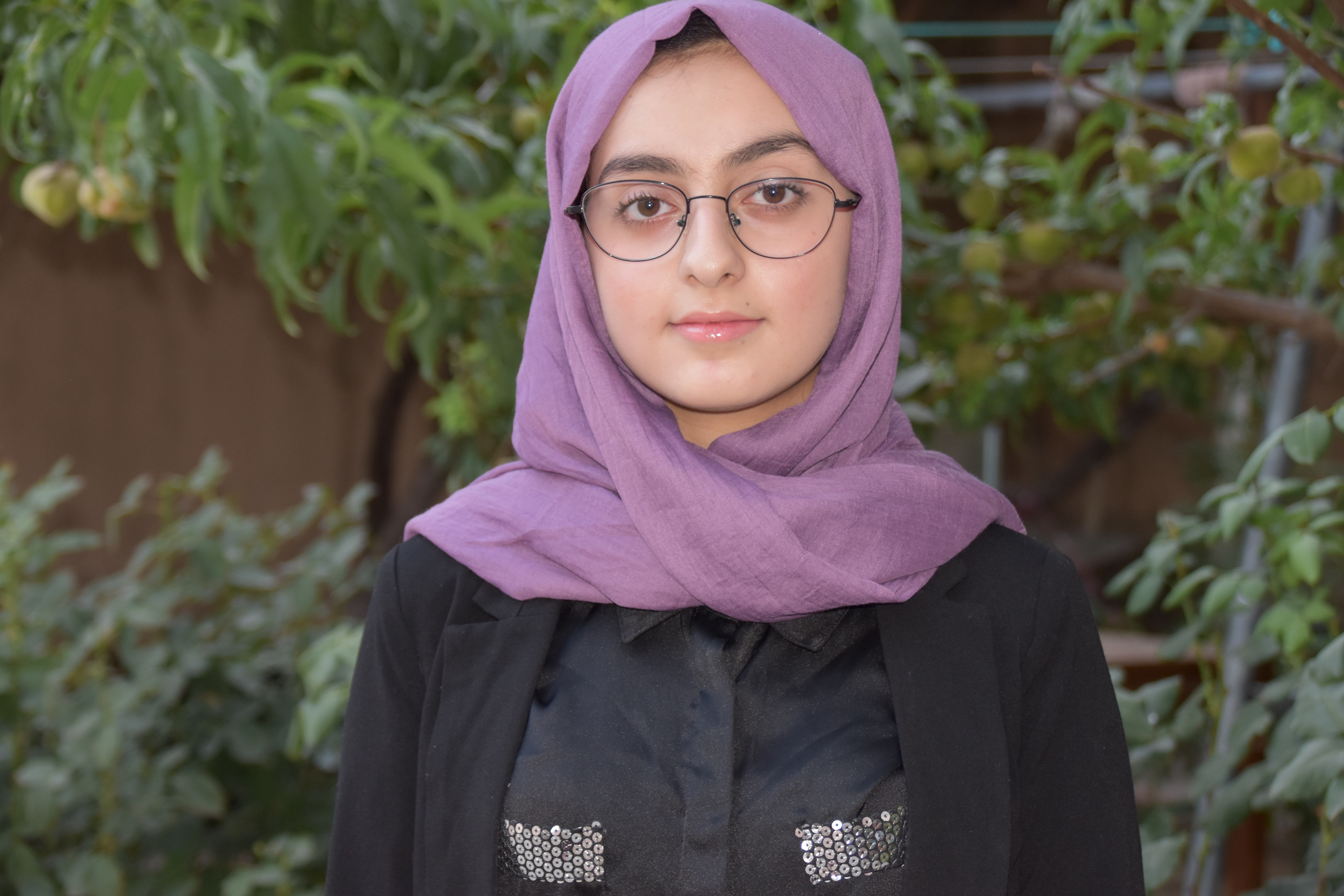
I am Madina Afshar from Afghanistan. I am student in eleventh grade. I am one of the mentees of SOW coders which work for women development in technology. Since I strongly believe in volunteerism and giving back to our society, I have always been passionate and committed to voluntary activities. I have worked as a volunteer at Integrity Watch Afghanistan and Cultural Committee of my school for a year. During my voluntary works, I organized more than 5 seminars for raising student’s awareness on pressing social issues of our community. Pursuing my passion in technology, I participated in ICT course at Womanity Foundation (WF) and SOW coders coding camp in summer 2020. Throughout SOW coding camp, I learnt how to develop my own web page that can be effective in addressing some social and development problems in my community. As a requirement of this course, I was assigned to design my own project on the issue which I care about the most in my community. As a result, I came up with the idea to Build a website for promoting tourism industry in Afghanistan. Because, Afghanistan, an ancient country holding a history of over 5000 years and a unique strategic location in Asia, has the potential to be the one of the best tourism centers in the world. Although this country was one of the significant tourism centers in Asia for many years, tourism revenue has been decreasing in recent years due to unstable political and economic situation which has adversely affected the number of visitors in tourist sites. I believe by improving this industry, we can create more employment, improve household income and living standard, and eventually contribute to an increase in Afghanistan GDP. Therefore, I planned to take the very first step in promoting tourism in Afghanistan throughout building this website which provide detailed information on tourist sites and available services to ease this process for visitors.